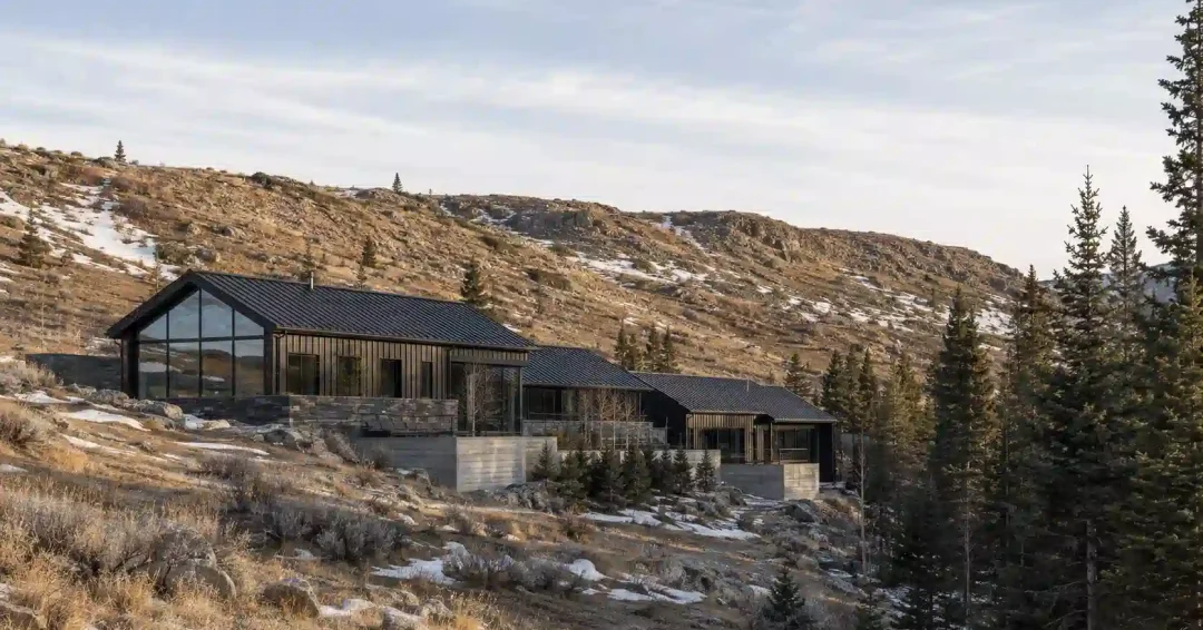
Almost every Park City land conversation opens the same way. The buyer has found the parcel. Ski access off the back of the property, a view down the canyon that sells itself in a single photograph, and one question. How large a house will it hold?
The honest answer from a Park City ski estate architect starts with subtraction. A ridgeline setback measured in vertical feet, an open space requirement tied to slope percentage, a thirty-two foot height ceiling, and in many cases a private review committee have already settled most of what any given parcel will allow, before anyone draws a line.
Purchased acreage and buildable acreage are different numbers in the Wasatch Back. Frequently they are very different numbers.
None of this argues against the parcel. It argues for reading the regulation while the purchase is still a question, because the rules here are written with more specificity than almost any market we work in. Owners who learn them early design once. Owners who learn them at submittal redraw.
Two Jurisdictions, and Your Address Picks One
The first thing I check on a new Wasatch parcel is which government reviews it. People say “Park City” to mean the whole valley. The regulatory line does not agree.
Inside the municipal boundary, Park City’s Land Management Code governs. Outside it, in the unincorporated Snyderville Basin, Summit County’s development code takes over. Several of the communities buyers most want sit on the county side, which means a different code, different thresholds, and a different planning staff.
On the county side, the zoning district sets your base density before anything else does. Rural Residential allows one unit per twenty acres on developable lands and one per forty on critical lands. Hillside Stewardship, written for ground with slopes generally between fifteen and twenty-five percent, allows one unit per thirty acres developable. Mountain Remote, the designation for parcels that service providers cannot easily reach, allows one unit per one hundred twenty acres.
Then comes the number that surprises nearly every client. In all three of those districts the maximum building or structure height is thirty-two feet.
Thirty-two feet is a generous two stories and a difficult three. It rules out the great lodge silhouette a lot of people arrive imagining, and it pushes the design toward stepping the house down the grade instead of stacking it up. That is a better building in this terrain anyway, though it is not usually what the first sketch looks like.
Which is why the land plan comes before the house plan. Where the structures sit, how many the district permits, and how they are served all resolve before massing is worth discussing.
One Hundred Feet Below the Crest
Every mountain buyer wants the high point. It is the most reliable instinct in the business and the most regulated ground on the mountain.
Summit County runs a Ridgeline Overlay zone. Its stated purpose is to stop development that lets a structure project into the horizon line as viewed from a designated roadway, and in new developments that outcome is prohibited outright. The mechanism is a setback, and the setback is measured vertically.
Minimum setbacks from the crest of a designated ridgeline run one hundred feet of vertical distance on either side. Inside that band the county’s development code allows no structure, no accessory structure, no satellite dish, no deck, no patio, and no removal of significant vegetation.
Read that carefully. One hundred vertical feet on a moderate grade can reach several hundred feet horizontally. On a knoll lot it can consume the entire top of the property.
Park City’s side of the line arrives at a similar place by a different route. Under the city’s Sensitive Land Overlay, one hundred percent of a Ridge Line Area has to remain in open space, and no structure or appurtenant device, mechanical equipment included, may visually intrude on that area from the designated Vantage Points. The written intent is that development should not create a silhouette against the skyline or the mountain backdrop.
Mechanical equipment is the detail worth pausing on. Condensers, flues, and snowmelt equipment are usually placed late in a project, and on a ridge lot that is far too late.
The city does allow the Planning Commission to transfer up to twenty-five percent of the density otherwise allowed in a Ridge Line Area onto developable land, subject to a suitability determination. So the value is not necessarily lost. It moves.
Steep Slope Is Arithmetic Before It Is Architecture
Park City’s slope regulation is the most quantitative piece of code I work with anywhere in the country, and it repays study. The city sets it out in the Sensitive Land Overlay chapter of its Land Management Code.
It begins with a document. A slope and topographic map, built on a certified boundary survey, showing contours at intervals of five feet or less. The map has to identify Very Steep Slopes within fifty feet of the property boundary, including slopes on the neighbor’s ground. Slopes get sorted where the terrain rises at least twenty-five feet vertically across at least fifty feet horizontally, into three bands. Greater than fifteen percent through thirty percent. Greater than thirty percent through forty percent. Very Steep Slopes, meaning anything above forty percent.
Those bands then drive the open space math, and the math is unforgiving.
On slopes above fifteen percent and up to forty percent, seventy-five percent of the steep slope area has to remain open space. Twenty-five percent may be developed, and the code does not let you choose which twenty-five percent. The developable portion is the area with the least visual and environmental impact, determined through the sensitive lands review against those same Vantage Points.
Above forty percent the answer is simpler. One hundred percent of a Very Steep Slope area stays in open space, and no vegetation within fifty vertical feet of it may be disturbed.
There is also a flat prohibition worth committing to memory. No development is allowed on or within fifty feet, map distance, of Very Steep Slopes, of areas subject to landslide activity, or of other high-hazard geologic areas. The Planning Commission can vary that setback on specific findings, and where it does, limits of disturbance around a structure shrink to the minimum area needed to excavate and backfill the foundation. Decks and patios inside the setback cannot extend more than fifteen feet past the foundation walls.
Access is governed too, and this is where estate schemes most often break. Streets and roads proposed on steep slopes may not cross grades of thirty percent or greater. A short run is permitted if the Planning Director and the City Engineer both sign off.
Sites fail on that clause alone. A bench can be ideal in every other respect, correctly oriented, gently graded, beautifully placed, and still sit behind ground no compliant road may cross. Sequencing the driveway study early is the whole lesson, and it is the same discipline behind architecture for sloped lots in any market, applied to a code that happens to publish its thresholds.
| What Gets Decided | Park City Municipal | Unincorporated Summit County | Private Club Review |
|---|---|---|---|
| Ridgeline protection | 100% of a Ridge Line Area stays open space, no visual intrusion from designated Vantage Points | 100 feet vertical setback either side of a designated crest, no structure, deck, patio or vegetation removal | Guidelines layer on top, reviewed against the recorded envelope |
| Steep ground | 75% open space from 15% to 40% slope, 100% above 40%, no build within 50 feet of Very Steep Slopes | Zoning district density plus low impact permit review where the overlay applies | Grading plan and disturbance limits reviewed |
| Height | Set by the underlying zoning district | 32 feet in Rural Residential, Hillside Stewardship and Mountain Remote | May be stricter than the public limit |
| Where the house sits | Sensitive lands review picks the developable portion | Development placed in the least sensitive part of the parcel | Recorded building envelope, fixed on the plat |
| What you submit | Certified survey, slope map at 5 foot contours, soils report | Development permit under the applicable review track | Site and house plans to an architectural review board |
| Who can say no | Planning staff and Planning Commission | County planning staff and Planning Commission | The committee, independently of any public approval |
The Building Envelope Is the Real Lot Line
Public code is only the first layer. In most of the communities where these estates get built, a private committee holds a second, independent veto.
The Colony at White Pine Canyon publishes its own numbers, and they illustrate the pattern better than any general description. The community covers roughly 4,600 acres and contains 274 single-family home sites across five phases. Approximately ninety percent of that land is dedicated as open space.
Each home site carries a designated building envelope of roughly one-half acre.
Sit with that for a moment. An owner can hold a lot measured in double-digit acres and design inside about half an acre of it. The envelope is recorded on the plat. It is not a guideline, and it does not move because the view is better forty feet north.
Within it the community permits a main residence, a separate guest house, and an accessory building. The guest house footprint cannot exceed 2,500 square feet. The main house carries no minimum or maximum size requirement, which sounds permissive until you remember that everything has to fit the envelope and the height limit together. Site and house plans go to an architectural review board, governed by recorded covenants and the community’s own design and development guidelines.
This is the single most useful reframing I can offer a buyer. The estate is not designed on the lot. It is designed inside the envelope, and every element competes for the same ground.
Garage bays for a mountain fleet. A ski room that actually works with wet gear. Guest quarters. Wellness space. A motor court that can turn a delivery truck in February. Each of those is a claim on a finite footprint, and the ones that get cut are usually the ones nobody prioritized in writing.
How Acreage Becomes Buildable Ground
Start with the deed. The full parcel, the number in the listing.
Remove the ridgeline band. One hundred vertical feet either side of a designated crest in the county, or the whole Ridge Line Area inside the city.
Remove the very steep ground. Everything above forty percent, plus a fifty foot buffer around it.
Keep a quarter of the moderate slope. Between fifteen and forty percent, three quarters stays open space.
Then apply the recorded envelope. In a covenanted community this can reduce the answer to roughly half an acre regardless of what survived the public code.
What remains is your site. Establishing that number early is the cheapest work in the entire project.
There Is No Single Park City Snow Load Number
Clients ask what the snow load is here, expecting one figure. Utah does not work that way, and the reason matters structurally.
The state’s building code amendment on ground snow loads tabulates values for a list of named cities, then directs everything else to the Utah Snow Load Study produced by Bean, Maguire and Sun at Utah State University. The study’s values are fifty-year estimates at a two percent annual probability of exceedance, bounded at a twenty-one pound per square foot minimum to satisfy ASCE 7. The university publishes the tool publicly, and it answers by coordinates. A town name will not get you a design load.
Elevation drives the answer. Two parcels on the same road at different benches can carry meaningfully different design loads, and the higher figure travels straight through the structure into roof framing, column sizing, foundation work, and cost.
So we pull the site-specific number during feasibility, not during construction documents. It belongs in the same early conversation as the slope map, for the same reason. It changes what the building wants to be. Anyone weighing a mountain parcel benefits from understanding how regional building codes shape design before the drawings begin.
Roof geometry follows from it. Where snow sheds, where it accumulates, what stands beneath the shed path, and how the entry stays usable in a heavy February all descend from a number somebody either looked up early or assumed.
What to Confirm Before You Close
Most of the expensive surprises in this market are discoverable during due diligence. Here is the sequence I run before advising a client to proceed on a Wasatch parcel.
- Confirm the reviewing jurisdiction. City limits or unincorporated county changes the entire ruleset, and the answer is not obvious from the mailing address.
- Check the overlay maps. Whether any portion of the lot falls inside a ridgeline overlay or a mapped Ridge Line Area, and where the designated Vantage Points and roadways sit.
- Order a slope map early. Certified boundary survey, contours at five feet or less, and identification of very steep ground within fifty feet of the boundary lines.
- Pull the recorded building envelope. Its exact dimensions and orientation, taken from the plat rather than from a marketing exhibit.
- Read the covenants and design guidelines in full. Height, materials, driveway grade, lighting, disturbance limits, and construction timing windows all live in that document.
- Get the site-specific ground snow load. From the coordinates, before anyone estimates structure.
- Test the access route. Whether a compliant driveway can physically reach the building area without crossing prohibited grades.
- Map the approvals calendar. Public review and committee review run on separate schedules, and mountain construction seasons are short.
Buyers who run this list before closing tend to buy better parcels for less money, because they can price the constraints up front. Discovering them mid-design costs considerably more. It is the same argument I make about finding land for a custom home generally, sharpened by a code that publishes exact thresholds.
For the design side of building here, the terrain response, the arrival experience, and how these homes actually live through a season, our guide to Park City luxury home architecture covers that ground in detail.
Frequently Asked Questions About Park City Ski Estate Architecture
What does a Park City ski estate architect do before any design begins?
We establish how much of the parcel is legally buildable. That means confirming the reviewing jurisdiction, checking ridgeline overlays, commissioning a slope map against the code’s own categories, locating the recorded building envelope, and reading the community’s design guidelines. The buildable area drives program, massing, and budget, so it comes first.
How tall can a home be on an estate lot in the Wasatch Back?
In unincorporated Summit County, the Rural Residential, Hillside Stewardship and Mountain Remote districts all set a maximum building or structure height of thirty-two feet, measured by the county’s own method. Inside Park City limits the underlying zoning district governs. A private community’s guidelines can impose something stricter, and often do.
Can I build on the ridgeline for the view?
Generally no. Summit County’s Ridgeline Overlay sets a minimum setback of one hundred feet of vertical distance either side of a designated crest, and bars structures, decks, patios, satellite dishes and significant vegetation removal within it. Park City requires one hundred percent of a Ridge Line Area to remain open space, with no visual intrusion from designated Vantage Points. The usual solution is to site just below the crest and design the roof so nothing breaks the horizon line.
How much of a steep lot is actually buildable?
Under Park City’s sensitive lands rules, seventy-five percent of any area sloping between fifteen and forty percent has to remain open space, leaving twenty-five percent developable. Above forty percent the entire area stays open, and no development is permitted on or within fifty feet of it. The location of the developable portion is determined through review. The owner does not get to pick it.
What is a building envelope and why is it smaller than my lot?
A building envelope is the recorded area of a lot where structures and improvements are permitted, with the balance held as open space. At The Colony at White Pine Canyon, for example, each home site carries a designated envelope of roughly one-half acre, and about ninety percent of the community’s 4,600 acres is dedicated open space. The envelope is fixed on the plat, so the design works within it.
Do I need the club’s approval as well as the county’s?
Yes, and they are independent. A public approval does not bind an architectural review board, and committee approval does not satisfy the code. The two run on separate schedules with separate submittal requirements, which is why we map both calendars at the start of a project and sequence them deliberately.
The Estate That Gets Approved
The parcel described at the start will hold a genuinely good house. Smaller in footprint than the buyer first pictured, stepped down the grade rather than perched on it, sitting below a crest that was never going to be available.
It is a better building for the constraints. Mountain codes are written by people who have watched what happens when houses ignore terrain, and working with that logic produces architecture that belongs to its site.
The owners who enjoy this process are the ones who front-load it. They know their buildable area, their height ceiling, their snow load, and their review calendar before they commit, and every design conversation afterward is about the house. Nothing gets relitigated. Our architecture consultation process is built to resolve exactly those questions in the right order.
If you are weighing a parcel above Deer Valley, in the Canyons corridor, or anywhere along the Wasatch Back, the most valuable hour you can spend is the one before you close.
Contact Ralston Architects to talk through what your Park City site will allow.