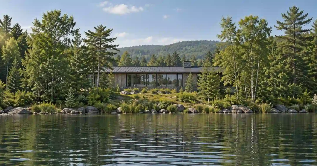
A lake house architect’s first job on a lakefront lot is to find where the house may stand, and that answer starts at the water’s edge. Each lake measures it from a different line. At Lake Tahoe, Flathead Lake in Montana and Lake Geneva in Wisconsin, the three examples used here, the line, the distance and the agency all change.
The shore also moves through the year. Ice pushes against it in winter and the waterline rises and falls, so both shape the plan before the view does. The rules quoted below are current as of October 2026, and your county or lake agency confirms how they apply to your parcel.
Lakefront estate design at a glance
Tahoe counts what a boat sees. Its scenic review measures visible area from 300 feet offshore.
Wisconsin guards the shore strip. Clear-cutting is limited in the first 35 feet inland.
Ice pushes. Setbacks help limit the damage it does.
Rooms sort by side. Living spaces take the water, and the entry takes the road.
Where the setback line starts on a lake
The first thing I ask about a lakefront lot is where the governing line falls on the survey, and which agency’s rule measures from it. On the three example lakes, that question has three different answers.
In Wisconsin the line is the ordinary high-water mark. The DNR’s statewide minimum sets buildings at least 75 feet back from it, with exceptions that include piers, walkways, stairways and boathouses. Wisconsin’s shoreland rules cover unincorporated land within 1,000 feet of a navigable lake, so on a lake such as Lake Geneva, first confirm the lot sits on unincorporated land.
Many Wisconsin counties have adopted requirements beyond the minimum. Paving has a limit too. A lot may have up to 15 percent of its area in impervious surfaces, or up to 30 percent with shoreland mitigation, so on an estate I plan the paved areas against that share from the start.
At Lake Tahoe, the house setback in the scenic review runs from the backshore boundary. The backshore is the land between the lake’s high-water line and the edge of wave run-up or unstable ground. The Code of Ordinances of the Tahoe Regional Planning Agency (TRPA) allows no new coverage there unless it serves an authorized shorezone use or accessory structure.
For a new visible house in the shoreland of a Shoreline Threshold Travel Route, the Code’s Basic Review is one of two paths the applicant may choose. Under it, the setback from the backshore boundary is 10 percent of lot depth and no more than 20 feet. So on any lot deeper than 200 feet, that Basic Review setback is 20 feet.
Montana’s statute works another way. Montana law defines the lakeshore as the lake’s edge at mean annual high water plus the land within 20 horizontal feet of it. Work that alters a lake or its lakeshore needs a permit from the local governing body first.
For a setback distance in Montana, read the local regulations for your lake. The same law lets a governing body with more than one lake adopt different regulations for each one, so the rules on Flathead Lake may not match those on a neighboring lake.
How Lake Tahoe reviews a lakefront house
A house on the Tahoe shore can answer to two reviewers. Most new single-family homes in the region are permitted by the local building department under agreements with TRPA, with Douglas and Washoe counties as the current exceptions, according to TRPA’s answers to common questions. A new house on a property visible from Lake Tahoe, though, “will likely have to be submitted to TRPA.”
TRPA itself is a bi-state body. Nevada and California established TRPA in 1969 through a compact with the consent of Congress, and it oversees development across the Lake Tahoe Region.
Land coverage sets one limit on a Tahoe lot. Coverage counts homes, driveways, parking and compacted soil. How much a parcel may carry depends on its soil type and other factors, set through a site assessment or an IPES score.
Scenic review sets another. Projects in the shoreland along routes TRPA designates as Shoreline Threshold Travel Routes are reviewed against its scenic standards. The shoreland runs 300 feet back from the high-water line, or less where the lakefront parcel is shallower, and the scenic assessment includes photos of the site from 300 feet and from a quarter mile offshore.
What the review counts is visible area, the surface of all structures in the shoreland that can be seen from 300 feet offshore, looking straight at the project. Under the Basic Review, a new visible house may show no more than 2,200 square feet of it, plus 165 square feet for each extra 10 feet of frontage past 100 feet.
A lot with 150 feet of frontage reaches 3,025 square feet, and that total covers a guest house or any other structure in the shoreland as well as the main house.
The scenic standards also ask for visual breaks, about 250 square feet of screening for every 1,000 square feet of lakefront facade, and TRPA may approve an equal or better alternative. Glass has a separate limit. Unscreened glass that throws sunlight glare onto Lake Tahoe may not exceed 11 percent reflectivity, and a project whose planting screens the glass, or whose orientation keeps glare off the lake, is exempt.
In modern lake house design at Tahoe, those rules turn the length and height of the lake-facing wall into a measured quantity. Under the Basic Review, every square foot of it that a boater can see from 300 feet out counts toward the cap.
Views across the water and privacy from it
A lake view runs both ways. The glass that frames the water also shows your living room to every passing boat.
Tahoe’s review measures that exposure. Wisconsin’s rules work on what screens it. A shoreline buffer, in the Wisconsin DNR’s description, is a vegetated strip of land that, among other jobs, “screens buildings when viewing from the water.”
The same statewide minimum bars clear-cutting of trees and shrubs from the ordinary high-water mark to 35 feet inland. Its listed exceptions include a viewing corridor of no more than 30 percent of the frontage or 200 feet. On a Wisconsin lot, then, the view comes through a corridor of limited width.
Frank Lloyd Wright’s 1958 Seth Peterson Cottage, his last Wisconsin building, sits on the edge of a steep wooded hill above Mirror Lake. Its roof frames the principal views west and south, and in the bedroom, the cottage’s conservancy notes, a ribbon of narrow windows under the roof gives light with “shelter and privacy.”
I sort the rooms of a lake house the same way. Living spaces take the open water, while bedrooms and baths get high windows, an angled wall or planting between them and the shore. The entry, garage and service areas go to the road side, the same split I use for privacy on a prominent lot.
Orientation is the second test. The lake side and the sun side of a lot are not always the same side, so I check where light and shadow fall through the day before deciding which rooms face the water. Prevailing winds belong in that check, since a terrace that faces the view may also face the wind.
Ice and a waterline that moves
Lake ice pushes on the shore. On Minnesota lakes, the state’s Department of Natural Resources explains, warming ice expands and “exerts a tremendous thrust against the shore.” The damage it lists runs from retaining walls, docks and boat lifts to, sometimes, the cabin itself.
Minnesota’s DNR adds that state and local setback rules help limit property damage from ice action and wave-driven erosion. I treat that as a design rule on any lake that freezes, so the house, its terraces and its stone walls stay out of the ground the ice works.
The waterline moves too. In TRPA’s Code, Lake Tahoe’s foreshore, the band between high and low water, runs from 6,229.1 down to 6,223.0 feet Lake Tahoe Datum, a vertical range of 6.1 feet.
So I set the lowest floor and the terraces from the high mark and study the shore at the low one. A stair to the water has to meet both levels, and so does a dock, a subject I cover in designing a boat-focused waterfront home.
What to check before you buy a lakefront lot
A lake parcel can look perfect and still hold a setback, a reviewer or a winter shore that reshapes the house. These checks are the lake-specific ones, and they sit on top of the general pre-offer list in my guide to finding land for a custom home.
Lakefront lot checks
- The permit path. Ask who issues the building permit and whether a lake agency also reviews the house, then plan the schedule around both.
- The water line on the survey. Ask the surveyor to locate the line the local rule measures from and draw the setback.
- The shoreland reach. Check how far inland the shoreland rules run, and in Wisconsin whether the lot is on unincorporated land.
- The footprint limit. Find the cap on how much of the lot can be built or paved, called land coverage at Tahoe and impervious surface in Wisconsin.
- The view from a boat. See the lot from the water, the way boaters, and at Tahoe the scenic review, will see the house.
- The shore trees. Note which trees screen the house from the water and which ones the rules protect.
- The winter shore. Look for retaining walls or docks along the shore that ice has damaged.
- The low-water shore. Ask how far the waterline moves between high and low water.
How a lake house architect starts a lakefront estate
At Ralston Architects, the study of a site starts with the ground itself. I look at how the terrain falls toward the water, where sun and shadow land through the day and which way the prevailing winds blow. On a lake I would rather finish that reading before you buy, the case I make for architect-led site selection.
On a lake parcel, the line on the survey and the reviewing agency come next. I also walk the shore for signs of ice and for the low-water edge. Only after that does the lake house design decide which rooms face the water and how long the lake-facing wall runs.
On a larger estate, some rooms can move into a guest house, and its place on the lot still matters. Wisconsin’s 75-foot setback applies to buildings and structures alike, and at Tahoe, visible area counts every structure in the shoreland.
Talk through your lake parcel
If you have a lakefront lot in view, or one already under contract, I would be glad to talk through what its shore asks of the house. Tell me the lake and the lot, and the conversation can start there.
Lakefront building rules and reviews
How far from a lake can you build a house?
It depends on the lake and on local rules. On unincorporated land in Wisconsin, the statewide minimum is 75 feet from the ordinary high-water mark, though a county may let a new home sit closer where existing homes already set a pattern, a rule called setback averaging. Your county zoning office confirms which figure applies to your lot.
How long does a TRPA review take?
Once TRPA finds an application complete, the agency strives to act within 120 days. That is its stated aim, not a guarantee. Most new single-family homes in the region are permitted locally instead, but a house on a property visible from the lake will likely go to TRPA.
What is a TRPA site assessment?
A site assessment verifies a parcel’s land capability, which sets how much coverage it may carry, along with the coverage already there. TRPA’s answers list El Dorado and Placer counties as the partners that also handle site assessments.
Does distance from the shore affect a vacant Tahoe lot’s IPES score?
It can. IPES gives vacant residential parcels a numerical score and ranks them within each local jurisdiction. One of its criteria favors parcels farthest from the shore of Lake Tahoe, where, in TRPA’s words, transport of pollutants to the lake is less likely.
Does a dam change where a Montana lakeshore starts?
Yes, where a dam sets the high water. Under Montana law, a highest elevation caused by a dam or other impoundment counts toward the mean annual high-water elevation. The lakeshore takes in the land within 20 horizontal feet of that mean elevation, so on a dam-controlled lake the dam’s highs help set where that strip begins. Work that alters the lake or that lakeshore needs a local permit first.